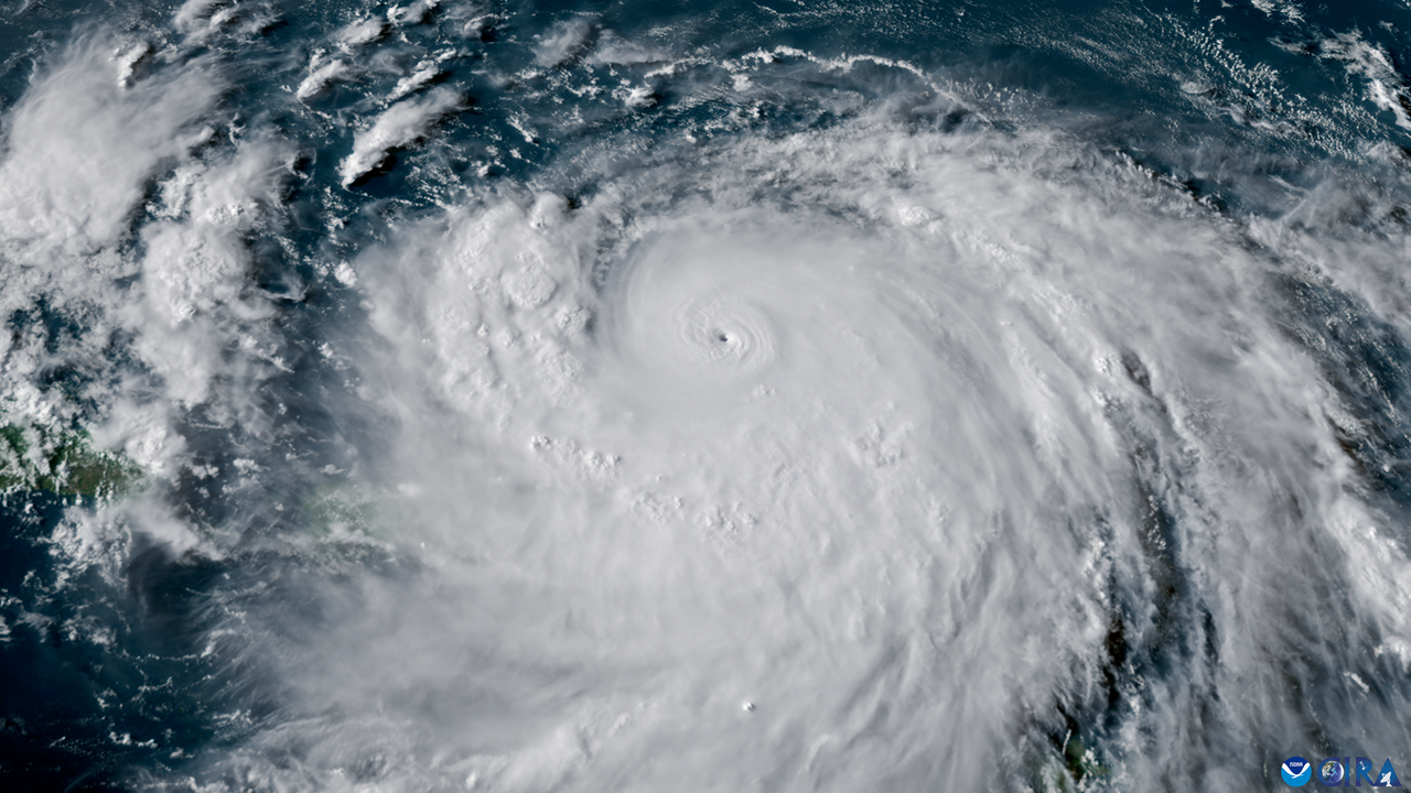
Coastal flooding and life-threatening rip currents are expected as Hurricane Erin barrels towards the East Coast this week, and the powerful storm has the potential to unleash 100-foot (30 meter) waves, forecasters warn.
Hurricane Erin emerged as the first hurricane of the 2025 Atlantic season over the weekend, rapidly intensifying on Saturday (Aug. 16) to become a Category 5, the strongest type of hurricane on the Saffir-Simpson Wind Scale. Erin then weakened and strengthened again and, at the time of writing, is a Category 4 with sustained wind speeds of about 130 mph (215 km/h).
The tropical storm is located just east of the southeastern Bahamas and is expected to travel between Bermuda and the East Coast by the middle of the week, according to a National Hurricane Center (NHC) update, published Monday (Aug. 18). While Erin isn’t set to make landfall, it will likely threaten coastlines with dangerous waves and flooding.
On Sunday (Aug. 17), the National Weather Service issued a coastal flood watch for the East Coast, with flooding forecast as early as Tuesday (Aug. 19). The Outer Banks islands off North Carolina are expected to be especially vulnerable. Dare County, which includes a large section of the Outer Banks, issued a state of emergency on Sunday with a mandatory evacuation order for Hatteras Island in anticipation of the flooding.
And the buzzsawing-passage of the storm could give extra energy to wind-driven waves, giving them enough energy to reach enormous heights.
“The latest forecast does indeed indicate that the largest significant wave height could reach values in excess of 50 feet with an associated most likely largest wave of more than 100 feet,” Jean Bidlot, an ocean and earth system modeling scientist at the European Centre for Medium-Range Weather Forecasts, told Newsweek.
The NHC also warned that the hurricane will lead to dangerous ocean conditions affecting the Bahamas, Bermuda, East Coast and Atlantic Canada over the next several days. “These rough ocean conditions will likely cause life-threatening surf and rip currents,” representatives wrote in the update.
Related: Here’s why storm surge during hurricanes can be so catastrophic
A hurricane is a type of tropical cyclone, or a rapidly rotating storm that forms over tropical oceans. For a tropical cyclone to be classed as a hurricane, it must generate maximum sustained wind speeds of 74 mph (119 km/h) or greater, according to NOAA. There are then an additional five categories of hurricanes, defined by increasing wind speeds from the 74 mph hurricane threshold (Category 1), all the way up to 157 mph (252 km/h) or higher (Category 5).
Hurricane Erin raced up the hurricane categories, from a Category 1 on Friday (Aug. 15) to a Category 5 on Saturday, making it one of the fastest intensifying storms in the history of the Atlantic, CNN Weather reported. The storm then weekend to a Category 3 on Sunday (Aug. 17), before picking up steam once more.
More hurricanes are rapidly-intensifying in the Atlantic as climate change causes atmospheric and sea temperature to soar. Since March 2023, average sea surface temperatures around the world have broken records, with warming waters adding extra energy to hurricanes as they grow.
As a Category 4, Erin is considered a major hurricane with sustained wind speeds of 130 to 156 mph (209 to 251 km/h) that would cause “catastrophic damage” to property, if there were any in its path. The hurricane also covers a large area, with its strong winds extending outward about 230 miles (370 km) and upwards about 80 miles (130 km), according to the NHC update.
Forecasters expect the hurricane to strengthen again on Monday, before experiencing some weakening overnight. However, regardless of this variation, Erin will continue to be a major hurricane that poses significant risks.
“Even though some weakening is forecast beginning tonight, Erin will remain a large and dangerous major hurricane through the middle of this week,” NHC representatives wrote.
